Maharashtra: MSRDC Plans GIS-Based Development Of 1,800 Sq Km Along Samruddhi Mahamarg, Covering 292 Villages
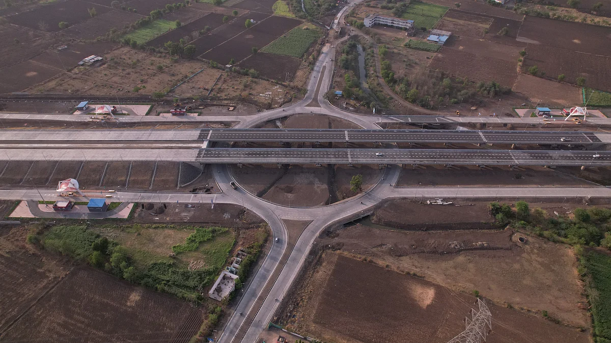
Mumbai, October 31, 2026: The Maharashtra State Road Development Corporation (MSRDC) is preparing to undertake a comprehensive land-use mapping and regional development planning exercise along the Nagpur–Mumbai Samruddhi Mahamarg, covering approximately 1,800 sq km and 292 villages spread across 10 districts.
The exercise follows the Maharashtra government's decision to appoint MSRDC as the Special Planning Authority (SPA) and New Town Development Authority (NTDA) for designated influence areas along the expressway through a notification dated June 24, 2026. The authority will now prepare statutory Development Plans to regulate land use, plan infrastructure and guide the region's future growth.
MSRDC has proposed appointing a consultant to prepare Geographic Information System (GIS)-based base maps, document existing land use and provide technical assistance in formulating development plans for the notified influence area.
The initiative aims to ensure that the rapid development expected along the 701-km expressway corridor takes place through planned interventions rather than uncoordinated construction. The region includes existing settlements, agricultural land, industrial estates, environmentally sensitive areas and emerging investment corridors.
Aerial Surveys And GIS-Based Mapping
As part of the exercise, the consultant will undertake aerial surveys using aircraft equipped with LiDAR sensors and high-resolution cameras, supported by GPS-based ground surveys and field verification. Satellite imagery with resolution better than 30 cm will also be used in locations where aerial surveys are not feasible.
The mapping exercise will capture individual land parcels and building footprints, including their existing use, built-up area, number of floors, structural characteristics and legal status. Residential, commercial, industrial, agricultural and mixed-use areas will be documented alongside government properties, public amenities, slums, vacant land and infrastructure facilities.
The study will also map roads, railway networks, bridges, water bodies, drainage systems, utilities, forests, wetlands and environmentally sensitive locations to create a comprehensive digital database.
Three Alternative Development Plans
Based on the existing land-use assessment, the consultant will prepare three alternative concept plans, from which MSRDC will select one for preparing the Development Plan.
The proposed planning exercise will examine the region's economic potential, connectivity, industrial growth, logistics requirements, tourism opportunities and infrastructure needs. It will also assess market demand and identify suitable locations for future development.
The planning framework is expected to focus on developing economic growth centres linked to road and railway connectivity while ensuring that local livelihoods are not overlooked. The concept plans will also consider skill-development programmes and centres to improve employment opportunities for local residents.
Land Acquisition And Investment Strategy
The exercise will also include preparation of a comprehensive land acquisition and financial implementation strategy for proposed infrastructure projects and development activities.
The consultant will identify land parcels required for roads, utilities, public amenities, industrial development, logistics parks and other public purposes. It will also examine ownership patterns, legal disputes and acquisition-related constraints.
Also Watch:
Different land procurement mechanisms, including direct acquisition, negotiated purchase, land pooling, land readjustment, Transferable Development Rights (TDR) and public-private partnerships, will be assessed.
A phased implementation roadmap covering project costs, funding arrangements, financial viability and institutional responsibilities will also be prepared.
To get details on exclusive and budget-friendly property deals in Mumbai & surrounding regions, do visit: https://budgetproperties.in/
This content is published by Free Press Journal and has not been created or edited by Hello Headlines. View original